
Explore Beautiful Marys Peak in the Oregon Coast Range
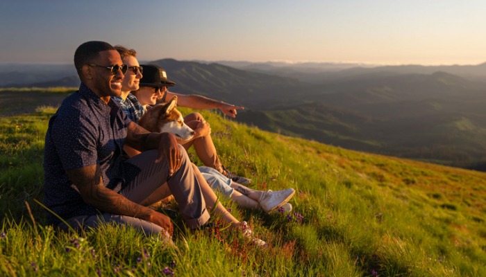
Marys Peak, the tallest peak in the Coast Range at 4,097 feet, dominates the Corvallis skyline. It offers several miles of multi-use trails and is dog-friendly (on leash only) and is a great place to bring the family for a day of fun, go hiking with friends, or even cuddle with a date while the sun sets.
A gorgeous 30-minute drive from Corvallis along HW-34 will lead you to the peak, where you can enjoy views that, on a clear day, showcase the Pacific Ocean to the west and the Cascades to the east. But the stunning views aren't the only thing Marys Peak has to offer.

Discover Marys Peak
During the spring, you'll find waterfalls cascading down Marys Peak, and in the spring and summer you can take in the wildflowers filling the meadows with color and butterflies. Autumn will offer panoramic views of fall color in the valley. During the winter, Marys Peak offers snowshoeing and skiing, as well as a place to get away from temperate Corvallis and see some snow.
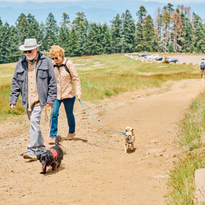
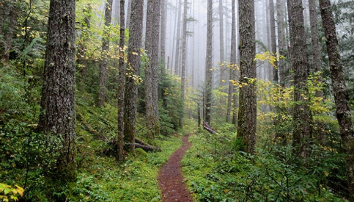
When not gazing into the distance, consider going for a forest stroll. Three trails wind between lower trail heads and the Day Use Area. The Summit Loop trail, for example, starts at the parking lot and leads down to forest and meadows where hikers can see wide-open views of the valley, the ocean and the trees above. The 1.5-mile walk ends with 500 feet of uphill trail back to the car.
There are several other trail choices with varying degrees of difficulty. The Meadowedge Loop hike is an easy open; a 1.6-mile loop walk from Marys Peak Campground that shows off meadows, forest and views of the Coast Range. The East Ridge Trail is 2.6 miles and requires uphill effort.
Then there’s the North Ridge Trail, a remote trail that extends 4.4 miles one way between the Woods Creek trailhead and the day use parking lot. Add another half mile or so to the very top and it becomes a 10-mile round trip with nearly 2,500 feet of climbing. Forest Service officials call this a challenging trail with a steep descent. That will work up a sweat. This also is a popular mountain bike route so watch out for riders.

While cyclists regularly ride from the highway to the top parking lot, it is not for everyone. Experienced cyclists who complete the task have bragging rights with friends.
More spots for hiking, biking and trail running: East Ridge Trail | North Ridge Trail | Tie Trail | Summit Loop Trail | Meadow Edge Trail.
Photo: Dan Shryock.
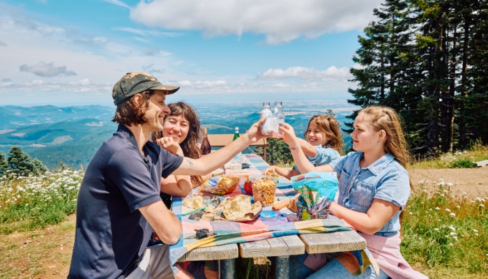
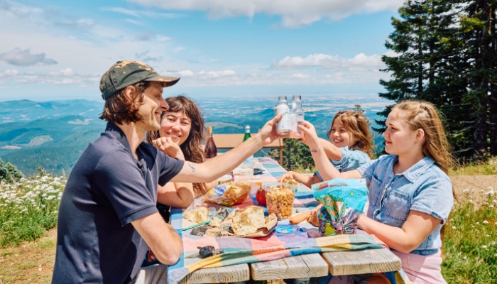
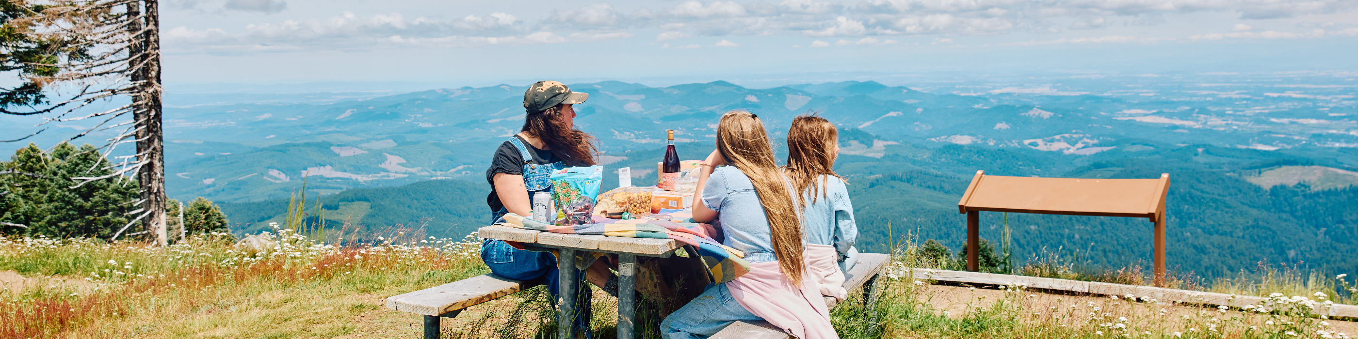
While people go to Marys Peak for outdoor activity, sometimes the best decision is to do nothing at all. This is a great place to sit, think, look at the vistas and listen to nature. Enjoy an outdoor lunch. There are picnic tables at the Day Use Area, Marys Peak Campground, the East Ridge trailhead and the Conner’s Camp Day Use Area near Highway 34.
Camping
The Mary's Peak Campground is just 19 miles west of Corvallis and just shy of 9 miles up Mary's Peak. The campground opens mid-May until around the middle of September. Six spots can handle an RV of up to 18 feet in length. Trailers are not advised here, however, as the windy roads makes getting there difficult. The spots are first-come first-served, so it's best to get up there earlier to give you the best shot at grabbing a space. You can learn more from the Siuslaw National Forest website or by calling 541-750-7000.
Virtual Field Trip to Marys Peak
The Marys Peak Alliance of AFRANA offers the Marys Peak Field Trip video online for the public thanks to a generous grant from the Frenkel Family Trust. It shows many of the remarkable aspects of Marys Peak and can be as enlightening to veteran Marys Peak visitors as it is to the first time visitor. Anyone interested in using this video for educational purposes might want to download this worksheet. You can also download the program time codes here.
Article and photo courtesy the Marys Peak Alliance of AFRANA.
Know Before You Go
Before visiting Marys Peak find helpful facts and resources. All visitors should be aware that the weather up on the peak can vary dramatically from the Willamette Valley below. Be sure to bring extra layers and rain gear, and be aware that rain can move in fast, bringing high winds with it.
Roads to Marys Peak from HW-34 are not maintained during the winter, and that the road up to Marys Peak is closed during the winter. Always prepare with alerts and be on the look out for potentially dangerous conditions, including heavy rains, slides, falling trees and debris, high winds and heavy snowfall.
Always carry the 10 Essentials and pack out what you bring in so everyone can continue to enjoy beautiful Marys Peak.
Photos by Autumn Shrock, Reed Lane Photography, Lainey Morse, and Dan Shryock.