
Marys Peak FAQs
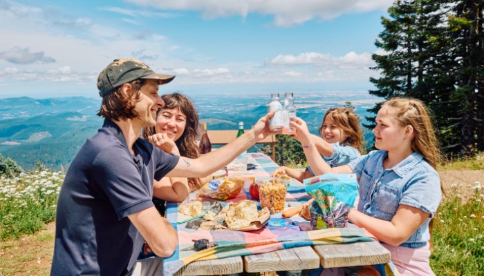
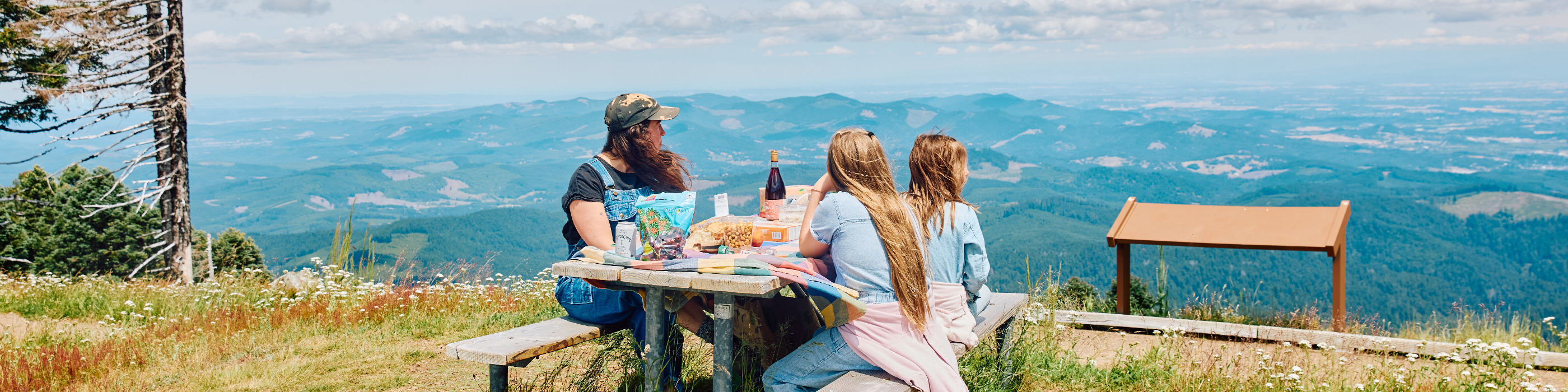
It's easy to spend a day - or even a few days, if you like camping - enjoying everything Marys Peak has to offer. Hike alongside rolling meadows and through soaring evergreen forests. Bring your bike and enjoy black diamond mountain biking through scenery that will take your breath away. Pack a picnic to enjoy after a short hike from the parking lot up to the peak itself.
General Information
- What and where is Marys Peak? Marys Peak is the highest point in the Oregon Coast Range, located west of Corvallis, Oregon. It is a designated Scenic Botanical Area.
- Where is Marys Peak located: Latitude: 44.509267 Longitude: -123.561465
- What is the elevation of Marys Peak? The peak has an elevation of 4,097 feet.
- What makes Marys Peak unique? The mountain is known for its incredible panoramic views that, on a clear day, can extend from the Pacific Ocean to the west to several Cascade mountain peaks to the east. Its unique plant life and meadows are also a special feature.
- Marys Peak is also known as Tcha Timanwi to the Kalapuya Tribe, the true natives of this area. The Kalapuya People believe Marys Peak holds spiritual power and it has been known as a place to seek empowerment.
- Is there an entrance fee or pass required? Yes, a day-use fee is required for vehicles parking at the summit Day Use Area. A variety of federal recreation passes are also valid.
Getting There and Accessibility
- How do I get to Marys Peak? From Corvallis, you can take Highway 34 west, then turn onto Marys Peak Road (Forest Road 30) and continue to the summit.
- Is the road to the summit paved? Yes, the road to the Day Use Area at the top is paved.
- Is the road open year-round? The road is open year-round, but it is not maintained for winter travel. Caution is advised, refer to updated alerts as snow and ice can make the road impassable.
- Is Marys Peak accessible for people with disabilities? The summit parking lots are paved and have accessible primitive vault toilets. While the trails are generally not considered adaptive-bike-friendly, the paved summit road offers great views.
Hiking and Recreation
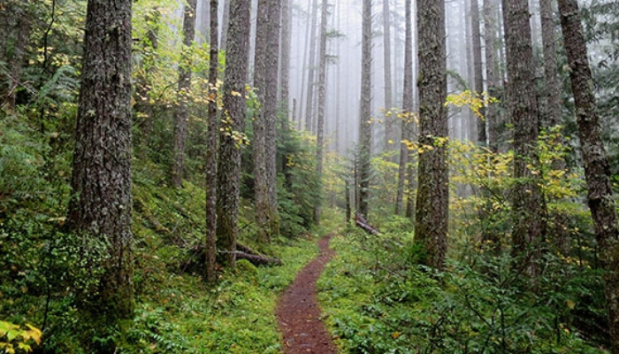
- What are the main hiking trails on Marys Peak? Popular trails include the Summit Trail (a short walk from the parking lot), the East Ridge Trail, and the North Ridge Trail.
- How difficult are the hikes? Trails range from easy to difficult. The Summit Trail is a short, easy walk from the parking lot. The East Ridge Trail is considered moderately difficult, while the North Ridge Trail is a longer, more challenging hike.
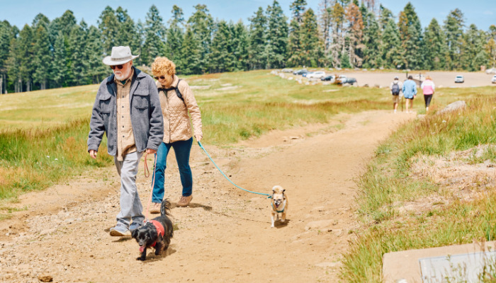
- Are dogs allowed? Yes, dogs are allowed but must be on a leash no longer than 6 feet.
- Can I go mountain biking? Yes, mountain biking is allowed on certain trails. Note that trails are often closed to bikes during winter months (e.g., October 15 to May 15). E-bikes are not allowed on non-motorized trails.
- What about winter activities? When there is snow, visitors can enjoy cross-country skiing, snowshoeing, and sledding.
Flora and Fauna
- What kind of plants and flowers can I see? Marys Peak is a designated Scenic Botanical Area known for its unique plant life. You can find beautiful wildflower displays in the meadows and rock gardens, including species that are rare for the Oregon Coast Range.
- Prairie Meadows near the summit have at least 10 species of grass and Noble fir forests of Marys Peak provides its own habitat
- When is the best time to see wildflowers? Wildflowers typically bloom from late spring through the summer months. While you won’t see every type of native wildflower on Marys Peak, you might be able to spot many of these common wildflowers found in the area.
- What kind of wildlife can I expect to see? Common wildlife sightings include deer and elk. More reclusive animals like black bears, bobcats, and cougars also live in the area. Various birds, including birds of prey, are also present.
Seasons and Safety
- Summer on Marys Peak offers waterfalls cascading down Marys Peak, and you can take in the wildflowers filling the meadows with color and butterflies.
- Spring offers wildflower viewing and stunning views from the summit if not socked in by cloud cover. Be sure to bring layers and be prepared for sudden shifts in weather.
- Autumn on Marys Peak will offer panoramic views of fall color in the valley if not socked in by cloud cover. Be sure to bring layers and be prepared for sudden shifts in weather.
- Winter on Marys Peak offers snowshoeing and skiing, as well as a place to get away from temperate Corvallis and see some snow. When there's snow, cross country skiing, snowshoeing and other non-motorized winter recreation are available, although the roads are not maintained for winter travel. In winter, caution is advised and you should refer to updated alerts as snow and ice can make the road impassable.
Amenities and Rules
- Are there restrooms and picnic areas? Yes, restrooms and picnic tables are available at the Day Use Area at the summit and at each campsite.
- Is there potable water available? No, there is no potable water available on the peak. You must bring your own.
- Can I camp on Marys Peak? Yes, there is a small campground with six tent-only sites. It is open seasonally (mid-May to mid-September) and is first-come, first-served.
- What are some important safety tips? Weather conditions can change quickly on the peak. Be prepared for colder temperatures and wind, even on a sunny day. Check the weather forecast before you go, and always be aware of potential hazards like falling trees or slides, especially after heavy rains or snow.
- Weather Alerts & Road Closures: Conditions can change rapidly on the Forest, especially at higher elevations and within backcountry areas. Forest roads are not maintained for snow and ice and are prone to flooding and washouts. Stay alert and prepare for various weather conditions. Always carry the 10 Essentials and pack out what you bring in so everyone can continue to enjoy beautiful Marys Peak.