


Corvallis & Benton County Travel Watch
We care about the safety of our community and guests in Corvallis and Benton County. This page is provided to offer information about current travel alerts in our area. Your safety and comfort are our top priority while you visit.
* This page was last updated on January 10, 2026.
Benton County Road Work Information

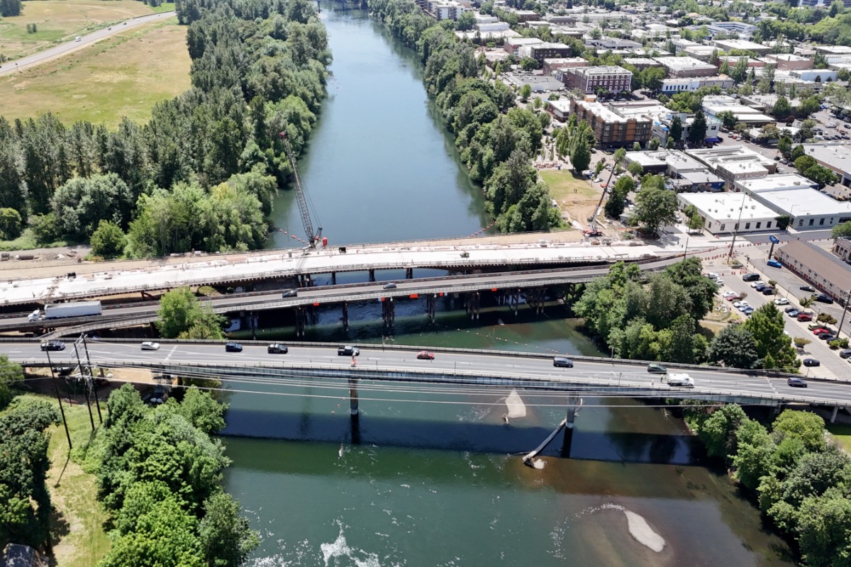
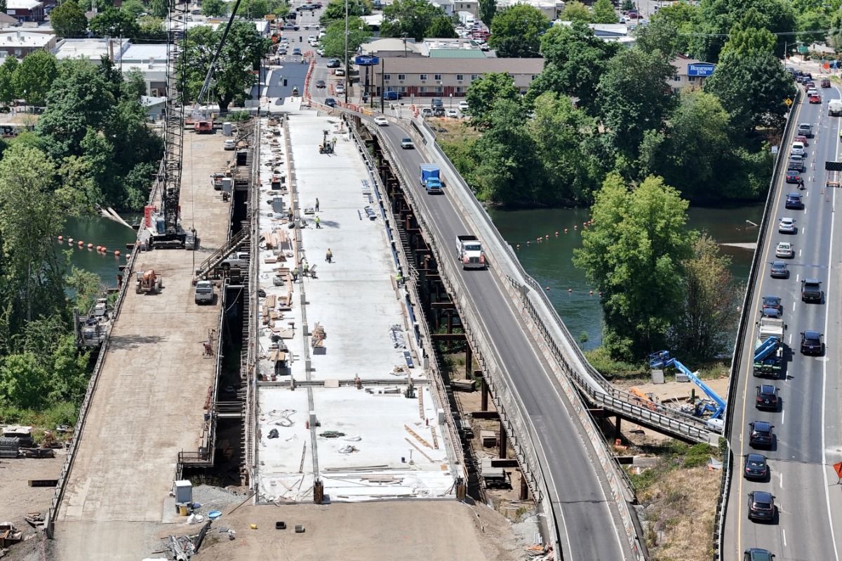
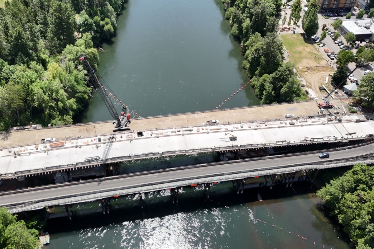
Van Buren Bridge Project
Effective Jan. 8, 2026, ODOT has opened the second lane on the Van Buren Bridge. The First Street and Van Buren Avenue intersection is back to two-way traffic.
The new bridge is built to modern seismic safety standards and is much stronger than the original 1913 structure. It has deep foundation shafts, reinforced concrete piers, and other modern design features to help it withstand a major earthquake. Crews are working to complete final paving and restoring the area. Multi-use path construction and connections at the ends of the new bridge, landscaping and finishing touches will continue into 2026.
Photos: Van Buren Bridge Project, Corvallis, Oregon, courtesy ODOT (CC BY 4.0).
Travelers looking for information on current road work and construction projects that may affect traveling in our area can visit the links below.
For more road construction, traffic, and road hazard information in Oregon, visit TripCheck.com.
Benton County Wildfire Information
Oregon's wildfire season usually starts towards the end of May or the beginning of June and ends with the first rains, usually in late September or early October. For complete and up-to-date information, visit Wildfire.Oregon.gov.
- For current information on wildfires in Oregon, visit the Wildfire.Oregon.gov or the NWCC Large Fire Map.
- For current information on air quality in Oregon, visit the Oregon Smoke Blog and the Oregon DEQ Air Quality Monitoring Data Map.
👉 If the AirNow.gov widget is not currently displaying Corvallis' air quality, please check the site directly by clicking here for Corvallis, Oregon's air quality, or clicking here to check the Oregon DEQ's air quality monitoring map.